| . |  |
. |
Columbus OH (SPX) Mar 09, 2010 The massive magnitude 8.8 earthquake that struck the west coast of Chile last month moved the entire city of Concepcion at least 10 feet to the west, and shifted other parts of South America as far apart as the Falkland Islands and Fortaleza, Brazil. These preliminary measurements, produced from data gathered by researchers from four universities and several agencies, including geophysicists on the ground in Chile, paint a much clearer picture of the power behind this temblor, believed to be the fifth-most-powerful since instruments have been available to measure seismic shifts. Buenos Aires, the capital of Argentina and across the continent from the quake's epicenter, moved about 1 inch to the west. And Chile's capital, Santiago, moved about 11 inches to the west-southwest. The cities of Valparaiso and Mendoza, Argentina, northeast of Concepcion, also moved significantly. The quake's epicenter was in a region of South America that's part of the so-called "ring of fire," an area of major seismic stresses which encircles the Pacific Ocean. All along this line, the tectonic plates on which the continents move press against each other at fault zones. The February Chilean quake occurred where the Nazca tectonic plate was squeezed under, or "subducted," below the adjacent South American plate. Quakes routinely relieve pent-up geologic pressures in these convergence zones. The research team deduced the cities' movement by comparing precise GPS (global positioning satellite) locations known prior to the major quake to those almost 10 days later. The US Geological Survey reported that there have been dozens of aftershocks, many exceeding magnitude 6.0 or greater, since the initial event February 27. Mike Bevis, professor of earth sciences at Ohio State University, has led a project since 1993 that has been measuring crustal motion and deformation in the Central and Southern Andes. The effort, called the Central and Southern Andes GPS Project, or CAP, hopes to perhaps triple its current network of 25 GPS stations spread across the region. "By reoccupying the existing GPS stations, CAP can determine the displacements, or 'jumps', that occurred during the earthquake," Bevis said. "By building new stations, the project can monitor the postseismic deformations that are expected to occur for many years, giving us new insights into the physics of the earthquake process." Ben Brooks, an associate researcher with the School of Ocean and Earth Science and Technology at the University of Hawaii and co-principal investigator on the project, said that the event, tragic as it was, offers a unique opportunity to better understand the seismic processes that control earthquakes. "The Maule earthquake will arguably become one of the, if not the most important great earthquake yet studied. We now have modern, precise instruments to evaluate this event, and because the site abuts a continent, we will be able to obtain dense spatial sampling of the changes it caused. "As such the event represents an unprecedented opportunity for the earth science community if certain observations are made with quickly and comprehensively," Brooks said. Working with Bevis and Brooks on the project are Bob Smalley, the University of Memphis, who is leading field operations in Argentina; Dana Caccamise at Ohio State, who is lead engineer, and Eric Kendrick, also from Ohio State, who is with Bevis now in Chile making measurements in the field. Along with Ohio State University and the University of Hawaii, scientists from the University of Memphis and the California Institute of Technology are participating in the project. Additionally the Instituto Geografica Militar, the Universidad de Concepcion and the Centro de Estudios Cientificos, all in Chile, also were partners. In Argentina. the Instituto Geografica Militar, the Universidad Nacional de Cuyo in Mendoza and the Unversidad Nacional de Buenos Aires are collaborating in the work. UNAVCO, a consortium of more than 50 institutions and agencies involved in research in the geosciences, is providing equipment for the project. The researchers have constructed a map showing the relative movement of locations after the Maule, Chile earthquake.
Share This Article With Planet Earth
Related Links OSU Tectonic Science and News
 Chile Quake Occurred In Zone Of Increased Stress
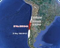
Woods Hole, MA (SPX) Mar 04, 2010 The massive, 8.8-magnitude earthquake that struck Chile Feb. 27 occurred in an offshore zone that was under increased stress caused by a 1960 quake of magnitude 9.5, according to geologist Jian Lin of the Woods Hole Oceanographic Institution (WHOI). The earthquake, some 300-500 times more powerful than the magnitude 7.0 quake in Haiti Jan. 12, ruptured at the boundary between the Nazca and ... read more |
|
| The content herein, unless otherwise known to be public domain, are Copyright 1995-2010 - SpaceDaily. AFP and UPI Wire Stories are copyright Agence France-Presse and United Press International. ESA Portal Reports are copyright European Space Agency. All NASA sourced material is public domain. Additional copyrights may apply in whole or part to other bona fide parties. Advertising does not imply endorsement,agreement or approval of any opinions, statements or information provided by SpaceDaily on any Web page published or hosted by SpaceDaily. Privacy Statement |