| . |  |
. |
Durham NC (SPX) Apr 25, 2011 Deforestation in parts of the Peruvian Amazon has increased six-fold in recent years as small-scale miners, driven by record gold prices, blast and clear more of the lowland rainforest, according to a new Duke University-led study. The study, published in the online journal PLoS ONE, combined NASA satellite imagery spanning six years with economic analyses of gold prices and mercury imports to document the forces responsible for deforestation in Peru's biologically diverse Madre de Dios region. Roughly 7,000 hectares, or about 15,200 acres, of pristine forest and wetlands were cleared at two large mining sites between 2003 and 2009, with a dramatic increase in deforestation occurring in the last three years. "In addition to these two large sites, there are many scattered, small but expanding areas of mining activity across Madre de Dios that are more difficult to monitor but could develop rapidly like the sites we've tracked over time," says Jennifer Swenson, assistant professor of the practice of geospatial analysis at Duke's Nicholas School of the Environment. Much of the deforestation visible in the satellite images has been caused by unregulated, artisanal mining by miners who are often among the poorest and most marginalized members of their society. "These are small-time miners; there is no big 'Goliath' mining company to blame," Swenson says. The miners often lack modern technology, have limited knowledge of mining's environmental or human health effects and rarely have safeguards to limit the release of the mercury they use to process their gold into the air, soil or water. Artisanal mining has occurred in the region since the time of the Incas, but the recent record-setting rise in gold prices, which now exceed $1,400 an ounce, has shifted its pace into hyperdrive, she says. The mining "is now plainly visible from space," Swenson says. "At the two sites we studied, Guacamayo and Colorado-Puquiri, nearly 5,000 acres were cleared in just three years, between 2006 and 2009, largely outpacing nearby deforestation caused by human settlement." Land cleared for mining has a different spectral signature on satellite images, allowing Swenson and her team to differentiate it from deforestation caused by farming, road-building or other settlement-related activities. Most of the gold mined artisanally in Madre de Dios comes from alluvial deposits in the channels and floodplains of Amazon tributaries. Miners blast away river banks and clear floodplain forests to expose potential gold-yielding gravel deposits and use mercury to process the gold ore. The mercury contaminates local water and soil, and ravages the nervous system of miners and their families, but the risks extend far beyond the local area, Swenson says. Small-scale gold mining is the second-largest source of mercury pollution in the world, behind only the burning of fossil fuels. Mercury from artisanal mines can travel hundreds of miles in the atmosphere or in surface waters - eventually settling in sediments and moving up the food chain into fish, fish-eating wildlife and humans. "Virtually all mercury imported to Peru is used for artisanal gold mining and imports have risen exponentially since 2003, mirroring the rise in gold prices," Swenson says. "Given the rate of recent increases, we project mercury imports will more than double by the end of 2011, to about 500 tons a year." It's been difficult for Peru's government to monitor and control all artisanal mining within its borders, she says, but another approach, worth considering, may be to be start limiting mercury imports. Swenson's co-authors were Catherine Carter of Tetra Tech Inc. in Research Triangle Park, N.C.; Jean-Christophe Domec of Duke's Nicholas School; and Cesar Delgado of the Environmental Affairs Office in Lima, Peru. Carter earned a Master of Environmental Management (MEM) degree from the Nicholas School in 2010. Delgado earned an MEM from the Nicholas School in 2008.
Share This Article With Planet Earth
Related Links Duke University Forestry News - Global and Local News, Science and Application
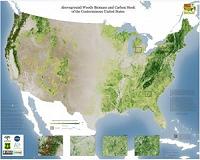
 WHRC debuts detailed maps of forest canopy height and carbon stock for the conterminous US
Falmouth, MA (SPX) Apr 25, 2011 The Woods Hole Research Center has released the first hectare-scale maps of canopy height, aboveground biomass, and associated carbon stock for the forests and woodlands of the conterminous United States. The multi-year project, referred to as the National Biomass and Carbon Dataset (NBCD), produced maps of these key forest attributes at an unprecedented spatial resolution of 30 m. Accordi ... read more |
|
| The content herein, unless otherwise known to be public domain, are Copyright 1995-2010 - SpaceDaily. AFP and UPI Wire Stories are copyright Agence France-Presse and United Press International. ESA Portal Reports are copyright European Space Agency. All NASA sourced material is public domain. Additional copyrights may apply in whole or part to other bona fide parties. Advertising does not imply endorsement,agreement or approval of any opinions, statements or information provided by SpaceDaily on any Web page published or hosted by SpaceDaily. Privacy Statement |