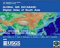
The American Geological Institute (AGI) announces the availability of educational site licenses for the Global GIS Digital Atlas. These licenses are affordably priced and permit unlimited educational and research use by the licensed users.
Depending on the license issued, students in a single classroom or throughout a country can generate thematic maps and produce integrated analyses using a large variety of Earth science and geographic data sets and the GIS software included with the product.
Developed by the U.S. Geological Survey (USGS) and distributed under a Cooperative Research and Development Agreement (CRADA) between the USGS and AGI, the Global GIS database contains a wide range of information from the USGS archives and from other public domain sources, including geology, hydrology, volcanoes, seismicity, ore deposits, energy resource data, climate data, and ecological regions.
Other useful geographical and cultural data, such as country boundaries, locations of cities, elevations, population density, roads, airfields, and utility lines, are also included in the atlas.
At a scale of 1:1 million or approximately 1 km resolution, the data are ideal for educators, researchers, government officials, the private sector, and the general public for conducting regional-scale customized analyses.
The Global GIS Digital Atlas consists of one DVD-ROM with the entire data set or seven regional CD-ROMs, and is designed for use with the GIS software provided or with Environmental Systems Research Institute (ESRI) ArcView software, version 3.0 or higher. Tutorials and other user and technical information about the Global GIS Series are available online.