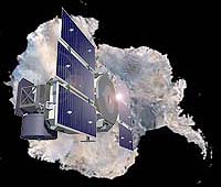
Icesat
Icesat |
The two instruments both measure the heights of clouds and aerosols, such as haze and particles in smoke, in the atmosphere from precise measurements of the travel time of the laser pulses and, in the satellite's case, calculated against its orbit and instrument orientation.
Both instruments are used in climate studies; the UW lidar is used particularly to finely tune numerical models of climate and weather, leading to increasingly better weather forecasts and a better understanding of Earth's climate.
Calibration tests are dependent on the weather to work well. Thick clouds keep the beams from meeting. The scientists hope for cirrus clouds or haze for the maximum effect, and best test�something we can see through, but that gives a nice signal.
NASA's Goddard Space Flight Center tentatively plans to test the GLAS this Friday afternoon, November 7. If the laser being tested is still on in mid-November�it may be turned off by then�the satellite will pass almost directly over Madison on the evening of November 11. Times will be known the day of the pass. If the weather is right, the UW lidar will be seen as a green beam and the satellite as a green flash, as captured in the video on the UW Lidar Web site.
The UW lidar program has been developing lidar instruments since about 1965, under the leadership of Edwin Eloranta, a scientist in the Department of Atmospheric and Oceanic Sciences. The researchers and engineers working with him are employed by the Space Science and Engineering Center (SSEC). Both groups are housed in the Atmospheric, Oceanic and Space Sciences Building, which also houses some research centers in the Institute for Environmental Studies.
The Arctic High Spectral Resolution Lidar will take measurements in the Arctic ice near Barrow, Alaska starting in 2005. The lidar is being tested in the top story of the building, beamed through a skylight. Images like the one below are now available on the Web where you can see how the lidar viewed the atmosphere on any day since the beginning of October.
Related Links
 DigitalGlobe Acquires eMap International
 Longmont - Nov 04, 2003