| . |  |
. |
|
|
. |
by Staff Writers Miami (AFP) June 8, 2011
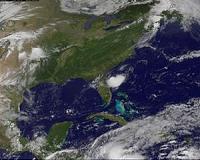
Adrian has become the first hurricane of the eastern Pacific region, the National Hurricane Center said Wednesday. The weak hurricane had sustained winds of 120 kilometers per hour (75 miles per hour) and was moving northwest at 15 kilometers per hour (nine miles per hour), forecasters at the Miami-based NHC said. Adrian became a Category 1 hurricane, the weakest of five categories, after its winds reached 120 kilometers per hour (75 miles per hour). The forecasting center said that as of 8:00 pm in Miami, (0001 GMT Thursday), Adrian was some 425 kilometers (265 miles) southwest of Acapulco, Mexico and 450 kilometers (280 miles) south of Zihuatanejo, Mexico. Most storm action in the eastern Pacific hurricane region takes place on the west coast of Mexico and the Pacific coasts of central America.
earlier related report Tropical Storm Adrian was about 285 miles (455 kilometers) southwest of the Mexican resort town of Acapulco, with maximum winds increasing to 70 miles (95 km) per hour, according to the US-based National Hurricane Center. A storm reaches hurricane status when winds rise to 74 miles (119 km) per hour. "Additional strengthening is likely during the next couple of days, and Adrian could become a hurricane later today," the NHC said in a report. While the storm was moving to the northwest and was expected to gradually turn westward away from land, the Mexican government took the precautionary step of issuing a tropical storm watch for its resort-dotted coast, from Acapulco westward to Punta San Telmo, NHC said. Tropical storm conditions are possible within the watch area by early Thursday, it said. High surf will reach the coast later Wednesday, and "these swells could cause life-threatening surf and rip current conditions." The latest forecasts show the eastern Pacific hurricane season, which began June 1, will likely feature nine to 15 named storms, and five to eight hurricanes, but with indications of 70 percent chance of a below-normal season, the National Oceanic and Atmospheric Administration (NOAA), which oversees the NHC, said last month. In the Atlantic, however, NOAA forecast elevated threats to the United States and Caribbean nations, with 12 to 18 likely named tropical storms, of which six to 10 could become hurricanes. Along the southeastern United States, which counted itself lucky in 2010 with no major hurricanes making landfall, some 37 million people -- living in coastal areas between the Gulf state of Texas and North Carolina, halfway up the US East Coast -- are at risk from powerful hurricanes. According to an April study by experts at Colorado State University, chances of a major hurricane pounding US eastern and southern shores this year stand at 72 percent, well above the average of 52 percent.
|
. |
|
| The content herein, unless otherwise known to be public domain, are Copyright 1995-2011 - Space Media Network. AFP and UPI Wire Stories are copyright Agence France-Presse and United Press International. ESA Portal Reports are copyright European Space Agency. All NASA sourced material is public domain. Additional copyrights may apply in whole or part to other bona fide parties. Advertising does not imply endorsement,agreement or approval of any opinions, statements or information provided by Space Media Network on any Web page published or hosted by Space Media Network. Privacy Statement |
 del.icio.us
 Digg
Digg Reddit
 Google