| . |  |
. |
Hobart, Australai (SPX) Apr 06, 2011 Marine scientists from five research agencies have pooled their skills and resources to compile a directory of life on Australia's continental shelf. They examined the shelf seascape during a three-year program of the Commonwealth Environment Research Facilities (CERF) Marine Biodiversity Hub. Hub director, Professor Nic Bax of CSIRO and the University of Tasmania, says the program developed and applied a consistent, national approach to biodiversity mapping. "The program compiled existing biological survey datasets, mapped 1868 square kilometres of seabed with multibeam sonar, recorded 171 km of underwater video, and collected nearly 1000 samples of seabed sediments and marine life," Professor Bax said. "At a national level we identified 37 environmental factors that shape seabed life, such as depth, oceanography, the type of seafloor, food availability, and the strength of currents and waves. "Statistical modelling was then used to predict seabed biodiversity, at a scale of one km 2, across more than two million km 2of the continental shelf. "Genetic techniques examined the links between biodiversity in different areas, and economic studies examined new options for biodiversity management." Professor Bax said the new maps and knowledge highlight the complex patterns of biodiversity across Australia's shelf habitats, while emphasising how much more we need to know. Some of the maps have already been used by the Department of Sustainability, Environment, Water, Population and Communities (SEWPaC) to improve its understanding of Australia's oceans as part of the marine bioregional planning process. All of the new information will be incorporated into the Australia Ocean Data Network and the Atlas of Living Australia to improve access to essential information on Australia's biodiversity. The program also completed finer scale mapping of previously unknown areas of the seabed in four important areas around Australia: Jervis Bay, Lord Howe Island, Southern-eastern Tasmania and Carnarvon Shelf. "These studies have helped local marine managers to fine-tune reserve design, and will assist in monitoring individual marine reserves," Professor Bax said.
Share This Article With Planet Earth
Related Links CEF Marine Biodiversity Hub Water News - Science, Technology and Politics
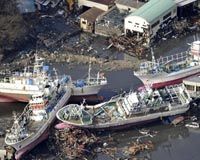
 Japan fishermen vow to rebuild tsunami-hit lives
Miyako, Japan (AFP) April 3, 2011 Fishermen whose livelihoods were devastated when the enormous tsunami hit Japan say they are determined to rebuild their industry on the sea that so cruelly turned against them. Hundreds of salmon, trout and mackerel fishermen were killed in Miyako when the huge wave slammed into the northeast coast. Many more lost their boats and the infrastructure that supported them was washed away. A ... read more |
|
| The content herein, unless otherwise known to be public domain, are Copyright 1995-2010 - SpaceDaily. AFP and UPI Wire Stories are copyright Agence France-Presse and United Press International. ESA Portal Reports are copyright European Space Agency. All NASA sourced material is public domain. Additional copyrights may apply in whole or part to other bona fide parties. Advertising does not imply endorsement,agreement or approval of any opinions, statements or information provided by SpaceDaily on any Web page published or hosted by SpaceDaily. Privacy Statement |