| . |  |
. |
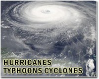
Miami (AFP) Sept 13, 2010 Hurricane Igor, swirling in the central Atlantic, strengthened early Monday, sparking concerns about possible flooding in the Caribbean, including in quake-devastated Haiti. Coming behind it was Tropical Storm Julia which formed overnight near the coast of Africa and was moving northwest after skirting the Cape Verde Islands. Igor, a powerful category four storm, was barreling west at 10 miles (17 kilometers) per hour, the Miami-based National Hurricane Center said. "A turn toward the west-northwest with some decrease in forward speed is expected to occur tonight or Tuesday," the NHC said. At 1500 GMT, the storm had maximum sustained winds near 150 miles (240 kilometers) per hour, up from 140 miles (220 kilometers) overnight. "Some fluctuation in intensity is likely during the next 48 hours," the center warned. "And Igor could become a category five hurricane today." The center of the storm was currently located 880 miles (1,420 kilometers) east of the northern Leeward Islands. Forecasters said Igor could brush the northern Caribbean, possibly heading toward Bermuda afterwards. Although Igor was not expected to hit land directly, the approach of the hurricane has sparked concern in the Caribbean basin about torrential rains that it could bring with it, including in Haiti, which is still recovering from a massive earthquake in January. Meanwhile, as Igor made its way across the Atlantic, a new tropical storm formed off the coast of Africa, with warnings being issued for the southern Cape Verde Islands. Tropical Storm Julia was projected to become a hurricane in the next couple of days, according to the NHC. At 1500 GMT, Julia was located 115 miles (185 kilometers) southwest of the Cape Verde Islands, packing sustained winds of 40 miles (65 kilometers) an hour, and dumping rain on the archipelago located off the western tip of the African continent. "Tropical storm force winds in squalls are occurring over portions of the southernmost Cape Verde Islands, but should diminish later today," the hurricane center said. "Additional rainfall accumulations of one to two inches are possible over the northwest portion of the islands with isolated maximum amounts of four inches possible," it said. "These rainfall amounts could produce life-threatening flash floods and mudslides," it warned. Early this week, powerful Tropical Storm Hermine slammed into far northeastern Mexico and then barreled into US territory, sparking flash floods on both sides of the border. Hermine came on the heels of Hurricane Earl, which gained category four status at its height in the Atlantic Ocean, whipping up heavy winds along the east coast of the United States and Canada.
Share This Article With Planet Earth
Related Links Bringing Order To A World Of Disasters When the Earth Quakes A world of storm and tempest
 Igor strengthens to category four hurricane
Miami (AFP) Sept 12, 2010 Igor, swirling in the central Atlantic and not a threat to land, strengthened to a powerful category four hurricane Sunday, the Miami-based National Hurricane Center said. Hurricane Igor "rapidly intensifies into a category four hurricane," on the five-level Saffir-Simpson scale, the NHC said in a special advisory. The storm had maximum sustained winds near 135 miles (215 kilometers) per ... read more |
|
| The content herein, unless otherwise known to be public domain, are Copyright 1995-2010 - SpaceDaily. AFP and UPI Wire Stories are copyright Agence France-Presse and United Press International. ESA Portal Reports are copyright European Space Agency. All NASA sourced material is public domain. Additional copyrights may apply in whole or part to other bona fide parties. Advertising does not imply endorsement,agreement or approval of any opinions, statements or information provided by SpaceDaily on any Web page published or hosted by SpaceDaily. Privacy Statement |