| . |  |
. |
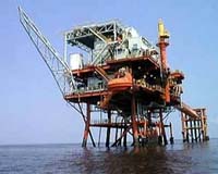
Washington DC (SPX) Jul 03, 2008 Hurricanes aren't the only hazards spinning up in the Gulf of Mexico -- they have a liquid counterpart in the waters below called ocean eddies. Offshore industries, such as oil and gas companies, have to keep a weather eye on both. In a worst-case scenario, they could find themselves caught between the two. Satellite altimetry is helping government and industry manage those risks. Satellite ocean observations are a standard part of marine operations around the world. Keeping track of local currents is critical for daily operations. And in the Gulf of Mexico, that means knowing the location of the Loop Current and its dangerous eddies. The Loop Current, which is part of the Gulf Stream, begins as a large flow of warm water from the Caribbean. It heads up into the eastern part of the Gulf of Mexico, then turns south and finally moves out through the Straits of Florida. Deep and fast moving, the Loop Current often breaks off and forms strong, clockwise rotating eddies called anticyclones that travel westward into the Gulf. The currents along the outer edges of the Loop Current, as well as these eddies, have been clocked at speeds as high as three to four knots (three to five miles per hour), comparable to the fastest ocean currents ever observed. Because the Loop Current and its eddies are warmer, and thus higher in surface elevation, than the surrounding waters, they are easily spotted by satellite altimeters, such as those aboard the NASA/French Space Agency Jason 1 and Ocean Surface Topography Mission/Jason 2 satellites. To see what the altimeters see, many offshore operators turn to Research Professor Robert Leben and his colleagues at the University of Colorado's Center for Astrodynamics Research in Boulder. They use the latest satellite measurements of sea-surface height from Jason 1 and two other satellite altimeters to create maps showing the location, direction and speed of currents in the Gulf of Mexico. Free and available on the center's Web site, these maps are used by a wide variety of people involved in marine operations, along with scientists, fishermen and sailors. As soon as measurements from the Ocean Surface Topography Mission/Jason 2 are available, they will be included in the data sets as well. For oil companies, knowing where the Loop Current and its eddies are and are likely to go is critical. "The rate to rent a drilling rig in deep water is about $300,000 a day," said George Forristall, of Forristall Ocean Engineering, Inc., Camden, Maine. "If you've planned an operation and the current is too strong, you have to shut down and spend that money without accomplishing anything. Once an oil field is found and a permanent facility is built, it floats on the surface and connects to the bottom by pipes called risers. You can protect those risers by streamlining them, but that costs a lot, too. Your riser design has to be appropriate for the currents you expect at your site." To plan and design rigs and oil platforms for the future, oil companies would like to be able to anticipate the sea conditions a particular facility may encounter in the Gulf of Mexico over its lifetime. A consortium of about 20 different companies, along with the U.S. Minerals Management Service, has asked Leben and Forristall to develop a model to help determine what the risks from strong currents may be. "We're constructing a 1,000-year-long statistical simulation of the Loop Current and its eddies," said Leben. "While we have only 20 to 30 years of observations, using computer simulation and the right statistical methods, we can figure out how the current and eddies behave and then simulate a longer period of time." "It's a modeling technique called Monte Carlo simulation," he continued. "For example, even if you don't know exactly how dice work, after a number of throws, you can figure out the probabilities for certain numbers to appear." "The idea," said Forristall, "is to map the Gulf. There are some places where there have only been a few eddies in the past. With our artificial time series, we'll be able to fill in the gaps. We'll be able to see what is the likelihood of an eddy occurring in a particular spot." Another goal of the effort is to better understand the relationship between the Loop Current and hurricanes, which grow stronger as they pass over warm water. Leben said results of the 1,000-year Loop Current simulation will be combined with simulations of how the Loop Current's warm surface waters and eddies effect hurricane intensification. "This will give us a way to assess the likelihood of warm Loop Current events and intense hurricanes and plan for them." "These tandem ocean/atmosphere events are rare, but they do occur," said Leben. "During Hurricane Katrina, when both strong eddy currents and a category-five hurricane hit the oil patch in the north-central Gulf of Mexico, a total of five rigs and 18 platforms were lost and many more were damaged." Knowing more about the Loop Current and its spinning offspring will help oil companies and other offshore industries plan for the future. "Nothing designed by man will ever be perfectly safe from natural hazards," said Forristall, "but the better we understand the environment, the better we will be able to manage risk at an acceptable cost." Community Email This Article Comment On This Article Share This Article With Planet Earth
Related Links OSTM/Jason 2 Water News - Science, Technology and Politics
 Seattle WA (SPX) Jul 03, 2008
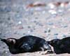
Like the proverbial canary in the coal mine, penguins are sounding the alarm for potentially catastrophic changes in the world's oceans, and the culprit isn't only climate change, says a University of Washington conservation biologist. |
|
| The content herein, unless otherwise known to be public domain, are Copyright 1995-2007 - SpaceDaily.AFP and UPI Wire Stories are copyright Agence France-Presse and United Press International. ESA Portal Reports are copyright European Space Agency. All NASA sourced material is public domain. Additional copyrights may apply in whole or part to other bona fide parties. Advertising does not imply endorsement,agreement or approval of any opinions, statements or information provided by SpaceDaily on any Web page published or hosted by SpaceDaily. Privacy Statement |
 del.icio.us
 Digg
Digg Reddit
 YahooMyWeb
 Google