| . |  |
. |
|
|
. |
by Staff Writers Brussels, Belgium (SPX) Oct 06, 2011
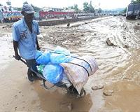
The EU Joint Research Centre (JRC) has developed a statistical modelling tool which allows the risk of conflict occurrence in developing countries to be analysed. Combining online news reports with geographical satellite data, the tool establishes a link between natural resources and the risk of conflict. A key advance is the very detailed scale of the data (most being gathered to the square kilometre) and the fact that the modelling is based on the seriousness of the conflicts. When tested, the model successfully identified the correlation between resource-rich areas of land and occurrence of conflict. This approach has potential use in the European Commission's development aid planning and crisis prevention. Commissioner for Research, Innovation and Science, Maire Geoghegan-Quinn, said: "This new tool developed by European researchers at the JRC can make a decisive contribution to resource management and conflict prevention in developing countries. A better understanding of the factors and conditions that lead to tension and insecurity will mean better decisions on aid and crisis prevention mechanisms." The model makes it possible to perform statistical comparisons between conflict events and geo-referenced datasets, such as those on natural resources (including mineral resources), land cover, distribution of population and economic activity, electrification rates, terrain and other geographical data. First results show that there is a link between conflict events and the proximity of mineral resource mines and grassland, and greater chance of conflict in areas where there have been conflicts in the past. The data collected by the JRC also show that many conflict events reported by the media are related to food issues: cattle raiding, conflicts between herders and cultivators, pillaging and conflict over access to water. The model was developed in the context of the project 'Global Atlas and Information Centre for Conflicts and Natural Resources', which focused on 18 countries from four regions: African Great Lakes, the Horn of Africa, Western Africa and Central Asia, analysing reports of over 1,500 conflict events. The information from the model is freely accessible here The "Global Atlas and Information Centre for Conflicts and Natural Resources" project is financed by the European Union's Instrument for Stability. The JRC used comprehensive, geo-referenced datasets. Some of these datasets were entirely created by the JRC, in particular the JRC Conflict Event Dataset. This was built up by analysing tens of thousands of online news articles to assess conflict occurrence, using an advanced information mining system, the JRC's European Media Monitor System (EMM). Information collated included the geographic location, severity, estimated number of victims and duration of each conflict event. Other factors related to conflict, such as economic, demographic and developmental conditions, were gathered from existing databases. Using statistical modelling, the main factors that can explain or predict the intensity and location of armed conflict were identified and described in the study report. The report 'Armed Conflicts and Natural Resources' can be downloaded here
EU Joint Research Centre Food Security monitoring at the JRC Bringing Order To A World Of Disasters A world of storm and tempest When the Earth Quakes
|
. |
|
| The content herein, unless otherwise known to be public domain, are Copyright 1995-2011 - Space Media Network. AFP and UPI Wire Stories are copyright Agence France-Presse and United Press International. ESA Portal Reports are copyright European Space Agency. All NASA sourced material is public domain. Additional copyrights may apply in whole or part to other bona fide parties. Advertising does not imply endorsement,agreement or approval of any opinions, statements or information provided by Space Media Network on any Web page published or hosted by Space Media Network. Privacy Statement |

 del.icio.us
 Digg
Digg Reddit
 Google