| . |  |
. |
Miami (AFP) Sept 15, 2010 The Atlantic was roiled Wednesday by a rare duo of powerful hurricanes, the first time there have been two such potent storms at the same time in more than a decade, weather forecasters said. "Two major hurricanes are occurring simultaneously in the Atlantic Ocean for the first time since 1999. Hurricanes Igor and Julia are both category four hurricanes," the Weather Channel reported, adding that neither storm poses an imminent danger to land. Igor, whipped up dangerous swells in the Caribbean on Wednesday as it barreled west-northwest in the direction of Bermuda packing sustained winds of 145 miles (230 kilometers) per hour. At 0900 GMT, Igor was a category-four hurricane, the second highest rating on the five-point Saffir-Simpson scale, the US National Hurricane Center said. A second hurricane, Julia, meanwhile, continues to gain strength. At 0900 GMT it had surged to category four strength, with top sustained winds at 135 mph (215 kph) per hour, tracking slowly west-northwest. Igor is not expected to make landfall for days, but forecasters say storm swells will reach Puerto Rico and the Virgin Islands by early Wednesday and move from there to Bermuda. They caution it is too early to know if it will be a direct hit or how strong it will be by then. Dangerous surf was also affecting the Leeward islands, and should affect some of the Bahamas Wednesday. "These swells are likely to cause life-threatening surf and rip current conditions," the Miami-based NHC warned. "Much more detail on Igor will be covered in the next few days, as it likely becomes a potential threat" to land, forecasters said. At 0900 GMT Wednesday, Igor's eye was located some 570 miles (915 kilometers) east of the northern Leeward islands and it was heading west-northwestward at nine miles (15 kilometers) per hour, US experts said. Though the storm's strength was expected to fluctuate in the coming days, Igor was expected to remain powerful through Thursday. Meanwhile, a smaller but still potent storm churning in the Atlantic, Tropical Storm Karl, was poised to do the most immediate damage. Karl barreled through the Atlantic on a path to Mexico's Yucatan peninsula early Wednesday. Although still relatively weak, the system threatens to dump more rain on Mexico, which is struggling with flooding in southeastern states including Veracruz and Oaxaca. Almost one million people were affected by flooding this month alone, which left 25 dead. The rains, which began in July, are set to worsen as the rainy season continues to almost the end of the year. More than one third of the Gulf coast state of Veracruz has been hit by flooding which affected some 500,000 people, according to governor Fidel Herrera. The Hurricane center said Karl could bring coastal flooding and up to eight inches of rain to Mexico and parts of Belize and northern Guatemala. "A storm surge is expected to produce some coastal flooding near and to the north of where the center makes landfall," the center said. "The surge will be accompanied by large and damaging waves. "Karl is expected to produce total rain accumulations of three to five inches over the Yucatan peninsula, Belize and northern Guatemala, with isolated maximum amounts of eight inches," the center added. Last week, tropical storm Hermine slammed into far northeastern Mexico and then barreled into US territory, sparking flash floods on both sides of the border. The recent frenetic storm activity comes after prediction from forecasters that the 2010 Atlantic hurricane season would be one of the worst on record. The National Oceanic and Atmospheric Agency (NOAA) predicted 14 to 23 named storms, including eight to 14 hurricanes, three to seven of which were likely to be "major" storms, with winds of at least 111 mph. This is compared to an average six-month season of 11 named storms, six of which become hurricanes, two of them major. NOAA said the period since 1995 has been one of unusually high storm activity with eight of the last 15 seasons ranking in the top ten for the most named storms.
Share This Article With Planet Earth
Related Links Bringing Order To A World Of Disasters When the Earth Quakes A world of storm and tempest
 Purdue Students Face Storm To Study Hurricane Development
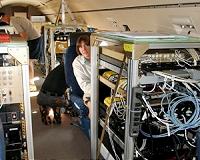
West Lafayette IN (SPX) Sep 15, 2010 After heavy rains and winds from Hurricane Earl pummeled their operations base in St. Croix, Virgin Islands, three Purdue University students continue to collect data as part of a team flying over the tropical Atlantic Ocean to take measurements of what might develop into tropical storm Gaston. Graduate students Alexandria Johnson, Brian Murphy and Paytsar Muradyan are part of a National S ... read more |
|
| The content herein, unless otherwise known to be public domain, are Copyright 1995-2010 - SpaceDaily. AFP and UPI Wire Stories are copyright Agence France-Presse and United Press International. ESA Portal Reports are copyright European Space Agency. All NASA sourced material is public domain. Additional copyrights may apply in whole or part to other bona fide parties. Advertising does not imply endorsement,agreement or approval of any opinions, statements or information provided by SpaceDaily on any Web page published or hosted by SpaceDaily. Privacy Statement |