| . |  |
. |
Paris (AFP) Jan 13, 2010 Invasive species that hitch a ride on cargo ships pose a rising threat to marine biodiversity, with the potential to inflict costs in the billions of dollars. But a new map of shipping networks should provide watchdogs with a useful tool against these stowaways, scientists in Germany said on Wednesday. Microbes, larvae, snails and other species are notorious for riding in ballast tanks or on ships' hulls to a new home. But until now there have been scant means of identifying ships or even shipping patterns to help pinpoint the source of the risk. Sleuths trying to track these intruders have generally used a so-called "gravity model" of ship movements. It assumes that journeys are likelier between nearby ports than between ports that are far apart. The truth, though, is rather more complex, say marine biologists led by Bernd Blasius of the Carl von Ossietzky University in Oldenburg. They used data from automatic transmitters, installed aboard large ships from 2001 to give port authorities the time of arrival and departure, to build a network of how the world's 16,363 large cargo vessels plied their trade in 2007. What emerged were small clusters of ports, sometimes based in a regional transport web, and journey lengths and port stays that differed crucially according to the type of ship -- bulk dry carrier, container or oil tanker. Container ships, they found, sail along largely predictable, repetitive routes among a small, dense linked cluster of ports, gathered in 12 regional "communities" around the world. For instance, a container ship may shuttle frequently around Europe, visiting Rotterdam, Hamburg and Antwerp, and around Buenos Aires, Montevideo and Santos in South America. These vessels travel fast (at between 20 and 25 knots) and spend less than two days in a port on average. In contrast, bulk dry carriers are more unpredictable, changing their routes at short notice according to the fluctuating supply and demand of the goods they carry. In the course of a year, they do few repeat trips on the same route. Oil tankers, too, also follow short-term market trends, but their destinations are limited, moving between ports with crude terminals and refineries. Both tankers and carries are slow movers, travelling at between 13 and 17 knots, and have a longer turnaround, spending around five or six days in port. Importantly, both bulk dry carriers and oil tankers often sail empty after offloading their goods, and take on large quantities of ballast water for trim, which is then discharged when they are laden once more. But frequency of trips, as seen in container ships especially, is also a factor. The more aliens that are offloaded in a new habitat, the better their chance of beating the odds of "ecological roulette," says the study. "With 90 percent of world trade carried by sea, the global network of merchant ships provides one of the most important modes of transportation" of intrusive species, says the study. The paper, published on Wednesday by Britain's Journal of the Royal Society Interface, quotes a 2005 estimate that bioinvasion inflicts a financial loss 120 billion dollars a year. Among the most notorious examples is a North American jellyfish, Mnemiopsis leidyi, that has so devastated native plankton stocks in the Black Sea that it has helped destroy several commercial fisheries. The European zebra mussel, introduced into the Great Lakes in the mid-1980s, has infested 40 percent of internal waterways in the United States. In southern Australia, the Asian kelp, Undaria pinnatifida, is invading new areas rapidly, displacing the native seabed communities.
Share This Article With Planet Earth
Related Links Water News - Science, Technology and Politics
 MMS Study Probes Mystery Of Loop Current In Eastern Gulf Of Mexico
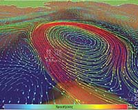
New Orleans LA (SPX) Jan 11, 2010 A study released by the Minerals Management Service examines the circulation in the Eastern Gulf of Mexico (GOM) and sheds new light on the behavior of the Loop Current (LC) and Loop Current Eddies (LCEs), the relation between the upper- and lower-layer currents, and the variability of water mass characteristics in deepwater. When the LC and the LCE are present in the Gulf near oil and gas ... read more |
|
| The content herein, unless otherwise known to be public domain, are Copyright 1995-2009 - SpaceDaily. AFP and UPI Wire Stories are copyright Agence France-Presse and United Press International. ESA Portal Reports are copyright European Space Agency. All NASA sourced material is public domain. Additional copyrights may apply in whole or part to other bona fide parties. Advertising does not imply endorsement,agreement or approval of any opinions, statements or information provided by SpaceDaily on any Web page published or hosted by SpaceDaily. Privacy Statement |