| . |  |
. |
Istanbul (AFP) Dec 15, 2009 Natural gas that lies under Turkey's Marmara Sea close to Istanbul could provide advance warning of an earthquake experts believe will hit the country's largest city, scientists said on Tuesday. Researchers from France and Turkey scanned the Marmara's seabed over six weeks using a robotic sonar device, similar to the kind of equipment used to detect shoals of fish. Their mission was to study the link between gas bubble expulsion and earthquakes along the North Anatolia fault, which lies some 20 kilometres (12 miles) to the south of Istanbul, the country's biggest city with 15 million people. Using the underwater robot, they found two points where natural gas was coming through the fault and believe by looking out for changes in these gas flows, earthquakes could be detected earlier. "We realised that the (gas) reservoirs...leak continually at two points (along the North Anatolia fault), one south of Istanbul and the other further west," said Louis Geli, a geophysicist with French Research Institute for Exploitation of the Sea. Naci Gorur, a seismologist from Istanbul Technical University, called for monitoring stations to be set up. "By installing observation points to monitor the changes to the fluids coming through the fault, it will be perhaps possible to detect early signs of an earthquake," said Gorur. Geli said experts predict another earthquake to hit the area shortly and called on Turkish authorities to set up two underwater observatories and a submarine research centre. He estimated the projects would cost between five and eight million euros (seven to 11 million dollars). The North Anatolia fault's eastern strand, the Izmit fault, ruptured in 1999 in two huge quakes that killed about 20,000 people in Turkey's densely-populated northwest. Its western strand, the Ganos fault, was responsible for a big quake in 1912.
USGS turns to Twitter for earthquake reports The US agency that tracks and reports on all earthquakes in this country and major temblors around the world said terse text "tweets" can provide instant assessments of what is felt when the ground shudders. The USGS has launched a Twitter Earthquake Detection (TED) project that continuously gathers tweets containing the word "earthquake" and its equivalent in other languages then meshes results in online maps of seismic activity. "Many people use Twitter to tell others what is going on around them," USGS scientist Paul Earle said Tuesday in an audio interview at the agency's website. "So after an earthquake they often rapidly report that an earthquake has occurred and describe the experience." Twitter users in areas shaken by earthquakes typically begin "tweeting" in seconds while it can take as long as 20 minutes for data from sensors to be analyzed, according to USGS scientist Michelle Guy. "The basic difference is speed versus accuracy," Guy said in the website interview. "Analyzing the tweets provides an early indication of what people experience before the quantitative information becomes available." Software filters out misleading references such as "earthquake brownie" desserts or the board game "Quake." Text messages regarding bona fide temblors and available information about locations of the people that sent them are merged with data from USGS sensors and mapped, according to Earle. "By collecting these tweets, which are open for anyone to search and analyze, it is possible to obtain firsthand accounts, albeit short, of what people experience during an earthquake," Earle said. Earthquake-related tweets with vague or missing location information are skipped, because the system is intended to pinpoint where shaking is felt and how strongly. Twitter, which allows users to pepper one another with 140-character-or-less messages, has grown rapidly in popularity since it was launched in August 2006 and claims millions of users. Share This Article With Planet Earth
Related Links Bringing Order To A World Of Disasters When the Earth Quakes A world of storm and tempest
 USGS: Earthquake warning system feasible
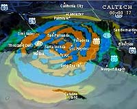
San Francisco (UPI) Dec 14, 2009 The U.S. Geological Survey says its research has determined an earthquake early warning system for use in California is feasible. USGS scientists said earthquake early warning systems, already successfully deployed in Mexico, Japan and Taiwan, can detect an earthquake in progress and provide notice of seconds to tens of seconds prior to actual ground shaking. After a three-year ... read more |
|
| The content herein, unless otherwise known to be public domain, are Copyright 1995-2009 - SpaceDaily. AFP and UPI Wire Stories are copyright Agence France-Presse and United Press International. ESA Portal Reports are copyright European Space Agency. All NASA sourced material is public domain. Additional copyrights may apply in whole or part to other bona fide parties. Advertising does not imply endorsement,agreement or approval of any opinions, statements or information provided by SpaceDaily on any Web page published or hosted by SpaceDaily. Privacy Statement |