
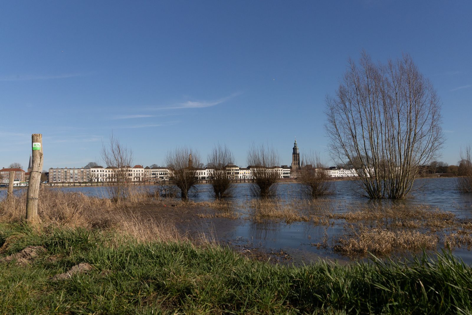
The country was the Netherlands, and its answer was Ruimte voor de Rivier, or Room for the River. Between 2006 and 2019, the government completed 39 projects that made space for high water at roughly 30 locations, using relocated dikes, lower floodplains, side channels and temporary storage areas. The programme increased the design discharge capacity of the Rhine branches from about 15,000 to 16,000 cubic metres per second while also reshaping farms, riverfronts and nature reserves.
What happened was not the abandonment of Dutch dikes. It was a change in geometry: instead of relying only on a higher barrier, engineers increased the area through which floodwater could move. At Nijmegen, that change lowered the calculated water level during an extreme Rhine flood by about 34 centimetres; elsewhere, it created controlled routes through which high water could pass without entering towns.
The shift followed two warnings. High water struck the Rhine and Meuse in 1993 and returned in January 1995, when authorities evacuated more than 250,000 residents and one million animals from the river region. The dikes held, but the evacuation showed how little margin remained between an anxious winter and a national disaster.
The winter that changed the calculation
At Lobith, where the Rhine crosses from Germany into the Netherlands, the 1995 discharge reached roughly 12,060 cubic metres per second. That was below the later 16,000-cubic-metre design standard, yet saturated dikes and forecasts of still more water made failure appear possible. For several days, empty villages stood behind embankments watched by soldiers, engineers and emergency crews.
The old response would have been familiar: reinforce a weak section, raise the crest and prepare to raise it again after the next revision of the flood standard. But making a river corridor narrower can push water levels higher and transfer pressure downstream. The Dutch still needed strong dikes, but the events of the 1990s made clear that the channel between them also had to change.
Parliament approved the Room for the River planning decision in 2006. Its safety target required the Rhine branches to carry 16,000 cubic metres per second at Lobith, while a second objective required projects to improve the spatial quality of the river landscape. A network of 19 public partners, including provinces, municipalities, water boards and Rijkswaterstaat, delivered different solutions at different sites.
The reversal was visible before the programme was complete. In 2007, Terra Daily reported from the Noordwaard, where farmland near Werkendam was being prepared to carry high river water again. Land painstakingly enclosed and drained by earlier generations was becoming part of the flood system.
How to lower a flood without lowering the rain
Room for the River was not one construction repeated 30 times. Rijkswaterstaat describes a toolbox that included moving dikes inland, excavating flood channels and lowering floodplains. Other projects lowered groynes, removed obstacles, deepened side channels or designated land for temporary water storage.
Each measure altered the river in a specific way. A setback dike increased the width available to the current; a side channel divided the flow around a bottleneck; a lowered groyne presented less resistance when the river rose. Together, the projects increased conveyance without assuming that every extra cubic metre had to be held between taller walls.
The target applied to the Rhine system at the national border, but the work extended across its Dutch branches and parts of the Meuse. This distinction matters because the Waal, IJssel, Nederrijn and Lek divide and redistribute Rhine water after it enters the country. An intervention at one bend can change water levels and flow conditions far beyond the construction site.
Nijmegen provided the clearest demonstration. The city moved the dike at Lent 350 metres inland and excavated a 3.5-kilometre flood-relief channel, creating an island and river park between the old city and its northern expansion. The project added three bridges, removed a constriction in the Waal and produced an estimated 34-centimetre reduction in extreme water levels.
That result came from working with the behaviour of a moving river rather than treating the channel as a fixed pipe. The same interaction among current, sediment and channel shape now informs research into how rivers select and abandon pathways, a process with direct consequences for flood planning and restoration.
What happened to the farms and floodplains
There was no single nationwide farmer-buyout scheme applied at every Room for the River site. Land requirements, compensation and relocation were handled project by project. Some households moved, some farms closed, and some agricultural businesses continued on land redesigned to flood under controlled conditions.
At Overdiepse Polder beside the Bergsche Maas, residents proposed a way to keep farming inside a 550-hectare water-storage area. Eight farms were rebuilt on artificial mounds placed against a new inland dike. Each mound rises about six metres, high enough to keep homes, barns and equipment above the design flood while the lower fields take water.
The arrangement did not make a flood invisible. When water enters the polder, livestock must remain inside, and the fields can no longer be used until the water recedes. The storage area can hold about nine million cubic metres and lower nearby water levels by an estimated 27 centimetres; pumps and drainage works are designed to return the land to agricultural use within about six weeks. The eight-mound design preserved farming, but only after a radical reconstruction of the landscape.
The Noordwaard followed a different path. Between 2012 and 2015, former agricultural land was reorganised as a flood-conveyance area connected to the Nieuwe Merwede. Lower sections of dike now admit water once it reaches a defined threshold, directing part of the flow through creeks and wetlands toward the sea.
Ten years after completion, Rijkswaterstaat reported that the redesigned area had become a tidal freshwater landscape of muddy banks, shallow creeks and reed beds. Water buffalo, Konik horses and Scottish Highland cattle keep vegetation short, while managers dredge creeks when sediment or plant growth could obstruct the flow. The ecological gains are real, but they depend on continuing maintenance rather than a river simply being left alone.
The result that could be measured
The programme’s central promise was a lower water level at vulnerable points for a given extreme discharge. Nijmegen’s 34 centimetres is the most visible figure, but the national result was a connected set of reductions across the Rhine branches and Meuse. Those centimetres matter because water that remains below a dike crest does not enter the homes, roads and farms behind it.
A larger test came during the extreme Meuse flooding of July 2021. Deltares found that Itteren and Borgharen stayed dry even though the peak discharge exceeded those recorded in 1993 and 1995, when both places flooded. Room for the River measures were not the only protection in the basin, but the comparison provided evidence that the redesigned system was doing useful work.
The national programme carried a budget of about €2.3 billion. That money bought flood capacity, but it also paid for bridges, parks, relocated infrastructure and redesigned public space. Spatial quality was an explicit programme objective, not an ecological benefit discovered after the engineering was finished.
This is why the island at Nijmegen is used every ordinary week, not only during a rare flood, and why the Noordwaard functions as habitat between high-water events. Research elsewhere has found that river restoration can reduce downstream flood peaks, but the Dutch programme shows how such measures can sit beside dikes, pumps and precisely modelled relief channels.
Why the answer is not simply to remove the dikes
Room for the River is sometimes described as the moment the Dutch stopped fighting water. The reality is more demanding. The Netherlands still reinforces dikes, operates barriers and pumps, and maintains strict flood-protection standards; giving rivers space added another layer to that system.
Nor is the new space unlimited. Deltares reported that with roughly three degrees of global warming, winter peak flow on the Rhine could increase by 8 to 15 percent. A separate KNMI high-end assessment placed the possible increase in Rhine peak discharge by 2100 within a much wider range, underscoring how quickly today’s safety margin could be consumed.
Flood channels also accumulate sediment, trees grow in conveyance corridors, and farms inside storage areas must be drained after an inundation. Rijkswaterstaat and the water boards therefore manage the spaces as infrastructure. A floodplain can lower a water level, but only if its channels, vegetation and inlets still perform as the hydraulic design requires.
The work has consequently moved into a new phase. The Dutch government’s Room for the River 2.0 programme is examining extreme high water, prolonged low water, navigation, freshwater distribution and erosion of the riverbed as parts of one changing system. The original projects altered the map; the successor must keep adjusting how water moves across it.
On a normal morning, the mounds at Overdiepse look like a measured line of farms above flat pasture, and the Nijmegen channel looks like part of the city. Their purpose becomes visible when winter rain gathers across the Rhine and Meuse basins. Then the lower land takes the water, the occupied ground remains above it, and a country protected by walls gains safety from the space between them.
